
Aerial Surveys
Capturing the big picture
Overview
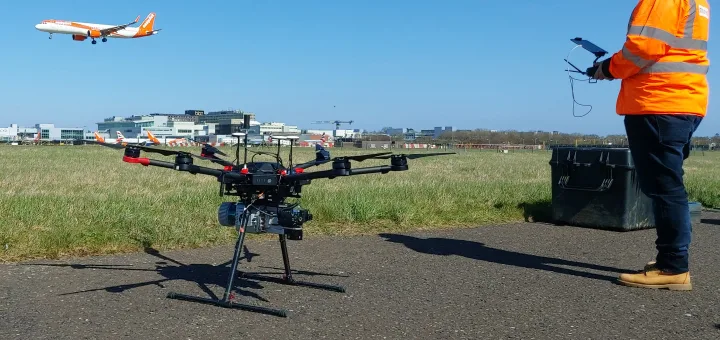
MK Surveys offer a variety of manned and unmanned Aerial Surveys to the highest standards, offering a unique perspective. Our remote pilots hold GVC certification issued by the CAA and use the latest drone technology to safely and professionally record high resolution visuals and accurate measurement data. Whether you require visual condition surveys, detailed maps, progress monitoring, or engineering grade deliverables, our aerial surveys are ideal.
Benefits
Why choose MK Surveys to complete your Aerial Surveys? Because our service offers numerous advantages:
Efficiency: We are able to deploy a range of market leading UAS (Unmanned Aerial System) to record critical measurement data rapidly, allowing for quicker informed decision-making, whilst minimising disruption.
Versatility: Our services are suitable for all types of projects from construction and engineering to environmental monitoring and agriculture, our aerial mapping surveys and inspection services adapt to your specific needs. The possibilities are endless.
Safety: The safety of our staff and the general public are always our top priority when considering any project which is why our CAA certified team are trained to the highest standards, operating under an Operational Authorisation and complete in-depth risk assessments prior to commencing any surveys, in accordance with PDRA01.
Accuracy: However accurate you need your survey deliverable to be, rest assured, we are able to meet with your requirements.
By adopting MK Surveys’ innovative methods, you too can streamline your project, reduce costs, and ensure high-quality results.



Experience
Since 1972, MK Surveys has been a trusted name in the surveying industry. Our team of industry experts combine decades of experience with cutting-edge technology to deliver exceptional results. For over 10 years we have successfully completed thousands of aerial mapping and unmanned inspection projects, earning the trust and confidence of clients across various sectors. With our expertise and dedication to quality, you can rest assured that your aerial survey needs are in capable hands.
Integrated Solutions
Whether it is aerial LiDAR or aerial imagery captured from our advanced survey drones, the precise data can be merged with data acquired via other surveying techniques such as:
- Mobile Mapping
- 3D Laser Scanning
- Conventional topographical surveying
- Terrestrial photogrammetry
- Ground Penetrating Radar
Deliverables
Accurate survey deliverables are processed in-house by our experienced surveyors using sophisticated and robust workflows allowing us to produce the deliverables you need to our renowned level of quality. These may include:
- LiDAR datasets
- Corridor mapping
- High-resolution drone imagery
- High-resolution drone video footage
- Visual Condition Surveys & reports
- 2D and 3D topographical surveys
- Orthomosaic outputs
- Digital Terrain Models (DTM)
- Digital Surface Models (DSM)
- Canopy Height Models (CHM)
- Change detection and isopachyte plans
- Confined space inspections
- Building elevations / orthophotos / roof plans
- 3D textured models
- Immersive VR environments and visualisations
- BIM, Digital Twins, and much more
Our deliverables provide you with the information you need to make informed decisions and keep your project on course for success.
Next Steps
Ready to elevate your project with our Aerial Surveys? Contact MK Surveys today to discuss your project requirements and get a tailored quotation. Our team is here to answer any questions you may have and help you take the next steps. Simply fill out the form below, and one of our experts will be in touch shortly.
Get in touch.
Our expert team is happy to discuss your project.

Milton Keynes Office
+44 (0)1908 565 561
MK Surveys,
1 Potters Lane,
Kiln Farm,
Milton Keynes
MK11 3HE
Oxford
+44 (0)1865 594 979
East Midlands
+44 (0)1162 849 127
West Midlands
+44 (0)1527 579 318
Sussex
+44 (0)1403 243 162