
 mail@mksurveys.co.uk
 01908 565561
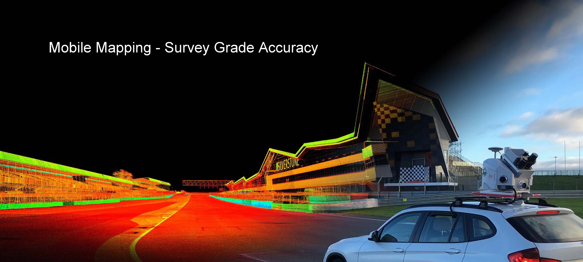

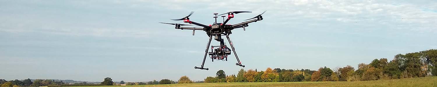
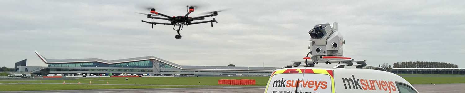
Drone / UAV Survey & Inspection Services
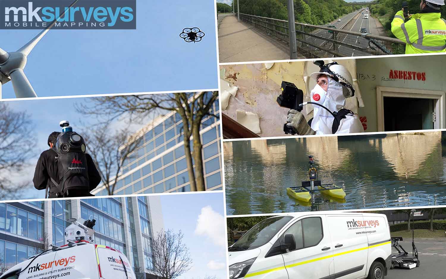
MK Surveys’ CAA certified pilots are able to rapidly record accurate measurement data safely and professionally using various UAV (Unmanned Aerial Vehicle) platforms, producing engineering grade deliverables. Safety whilst undertaking any survey is our top priority and all UAV surveys are successfully completed once all risks on site have been assessed and mitigated.
Accurate survey deliverables are processed in house by experienced surveyors using sophisticated and robust processing workflows, always with the importance of sufficient survey control and measurement redundancy in mind.
The aerial data captured (LiDAR and/or aerial imagery) by our advanced aerial systems can be merged with a variety of other formats, acquired using many of our other surveying techniques to produce 2D and 3D topographical surveys and DTMs (Digital Terrain Models), building elevations and roof plans, 3D building models, immersive VR environments and visualisations, BIM and much more.
20180911Milton Keynes Surveys Limited Trading As MK SurveysPAndEUAS7526

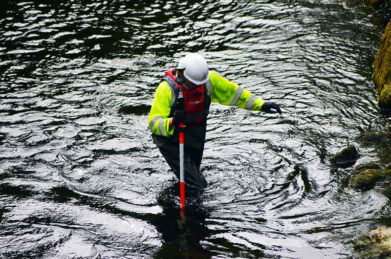
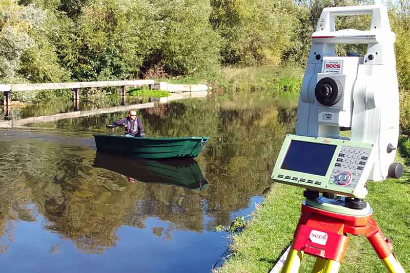
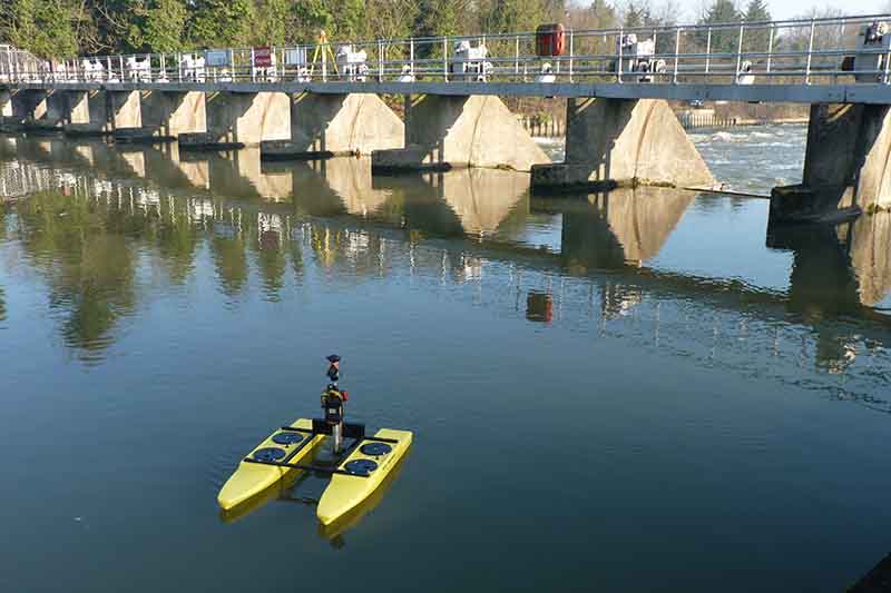
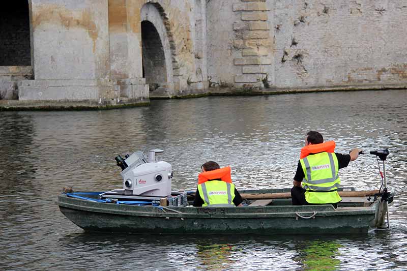
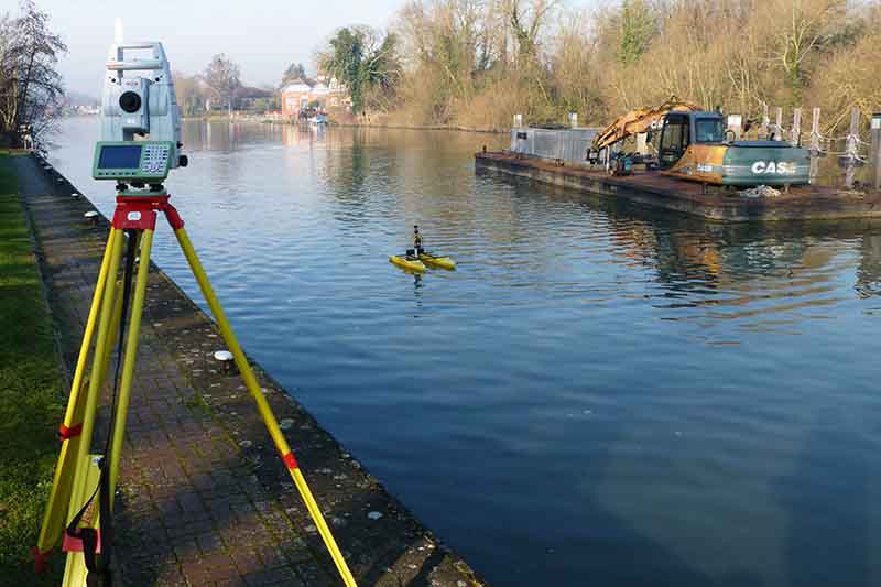
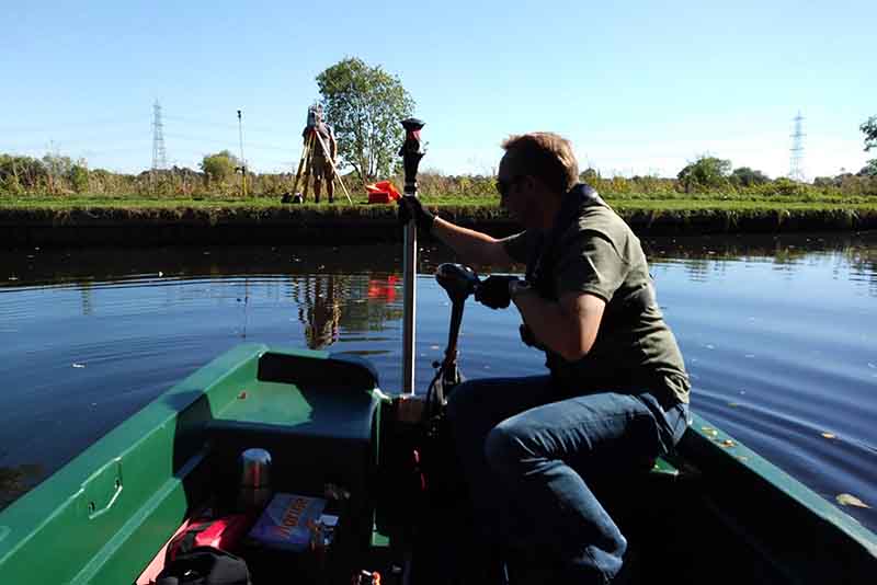
MK Surveys have many years experience in the production of hydrographic surveys to inform Flood Risk Assessments (FRA’s) of towns and villages suffering from repeated flooding and also the production of cross sectional surveys and monitoring of flood barrier systems and watercourses for the Environment Agency.
The hydrographic survey often forms part of a topographical survey to incorporate data from either remotely operated or boat mounted sonar systems. Pairing high accuracy survey equipment and sonar, we are able to extend ground modelling and DTM triangulation below the water surface to provide fully contoured bed and channel models.
With staff trained for working in confined spaces, working at height and for the safe use of off-road vehicles and powerboats, we are able to mobilise experienced survey teams to tackle any project.
Our surveys can go further still; utilising a variety of sampling systems to take physical samples from the river or lake bed, bagging each sample for analysis, with every sample geolocated to enable the comparison of bed material along a watercourse or across body of water.
We are experienced in;
 Inland Waterway Surveys
Port & Harbour Surveys
Reservoir Surveys
River Cross Section Surveys
Bathymetry Mapping
Surveys For Engineering Inspections
Threshold Level Surveys
LiDAR Data Capture From Vessels
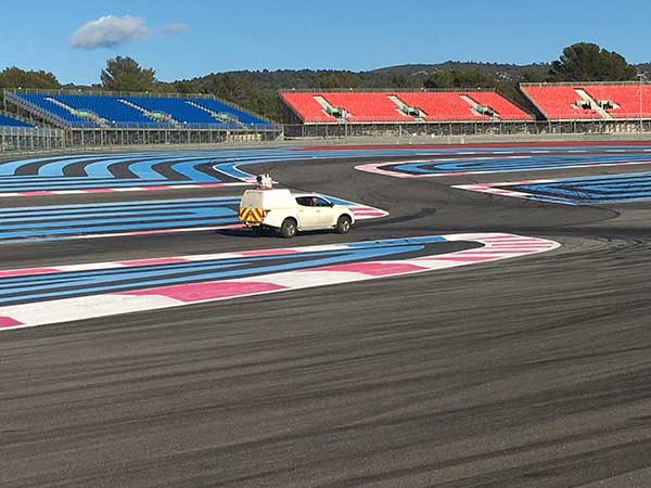
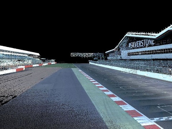
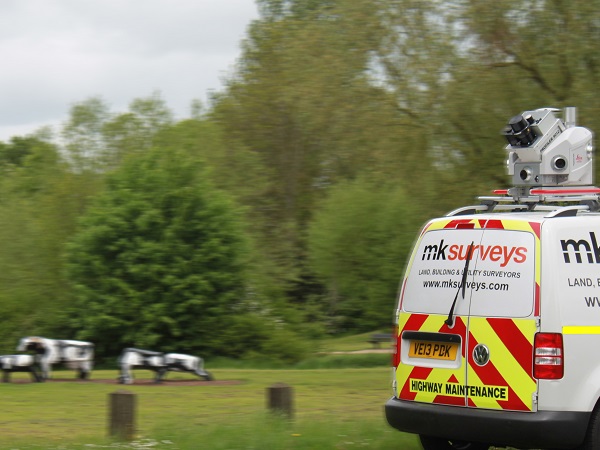
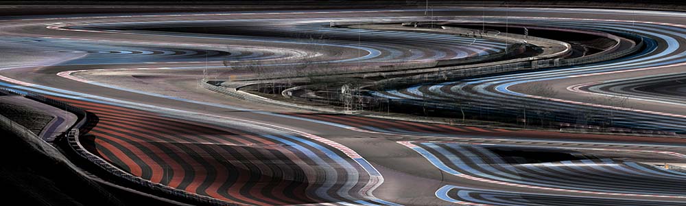
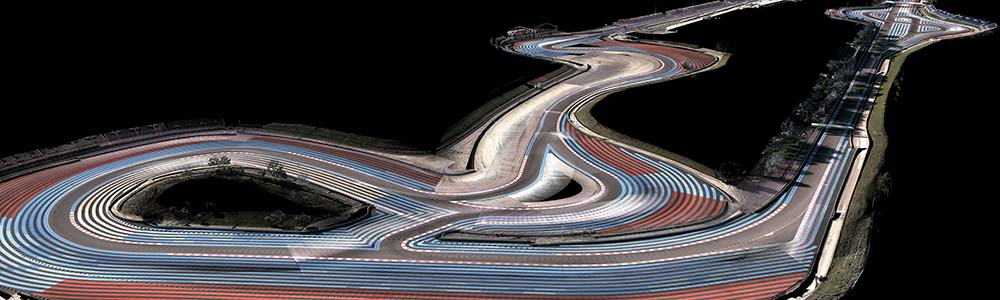
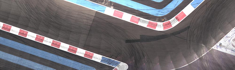
Mobile Mapping and measurement using the latest technology;
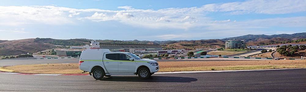
Vehicle mounted: Leica Pegasus:Two
Mobile mapper for various infrastructure projects including surveys of highways, rail, structures as well as GIS data collection and asset management.
All data is collected remotely from a moving vehicle to survey grade accuracies whilst drastically reducing man hours and addressing critical health and safety considerations on site.
Speed - Accuracy - Safety

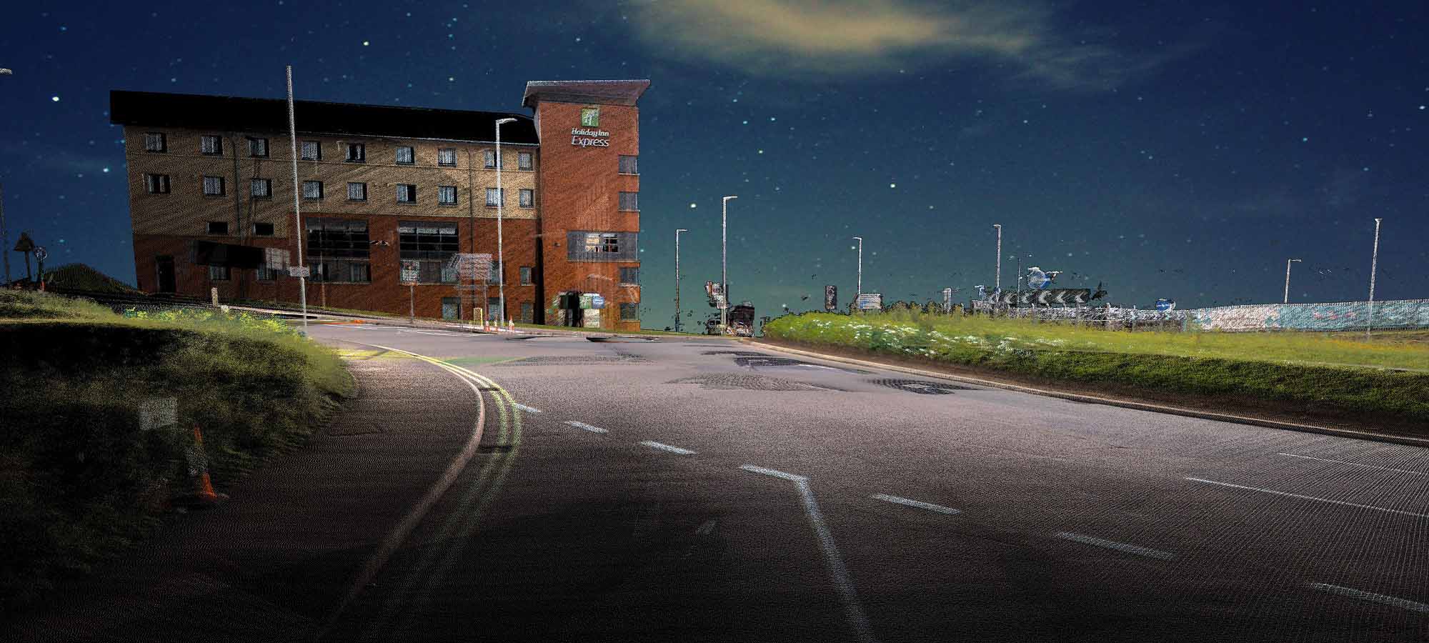
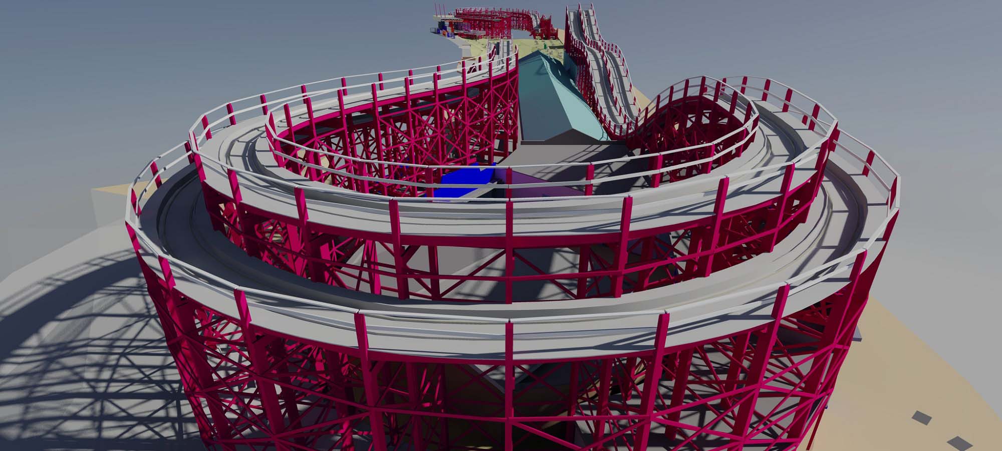
Drone / UAV Survey & Inspection Services
MK Surveys’ CAA certified pilots are able to rapidly record accurate measurement data safely and professionally using various UAV (Unmanned Aerial Vehicle) platforms, producing engineering grade deliverables. Safety whilst undertaking any survey is our top priority and all UAV surveys are successfully completed once all risks on site have been assessed and mitigated.
Accurate survey deliverables are processed in house by experienced surveyors using sophisticated and robust processing workflows, always with the importance of sufficient survey control and measurement redundancy in mind.
The aerial data captured by our advanced aerial systems can be merged with a variety of other formats, acquired using many of our other surveying techniques to produce 2D and 3D topographical surveys and DTMs (Digital Terrain Models), building elevations and roof plans, 3D building models, immersive VR environments and visualisations, BIM and much more.
20180911Milton Keynes Surveys Limited Trading As MK SurveysPAndEUAS7526

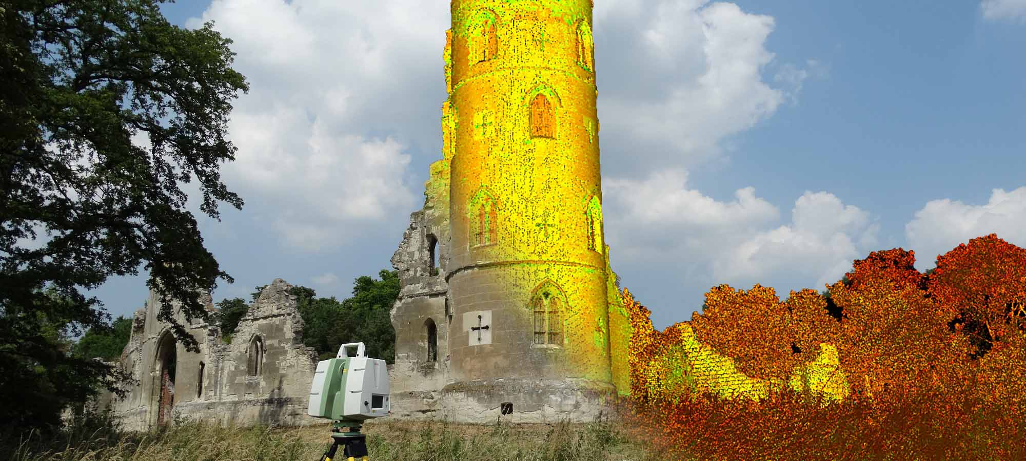
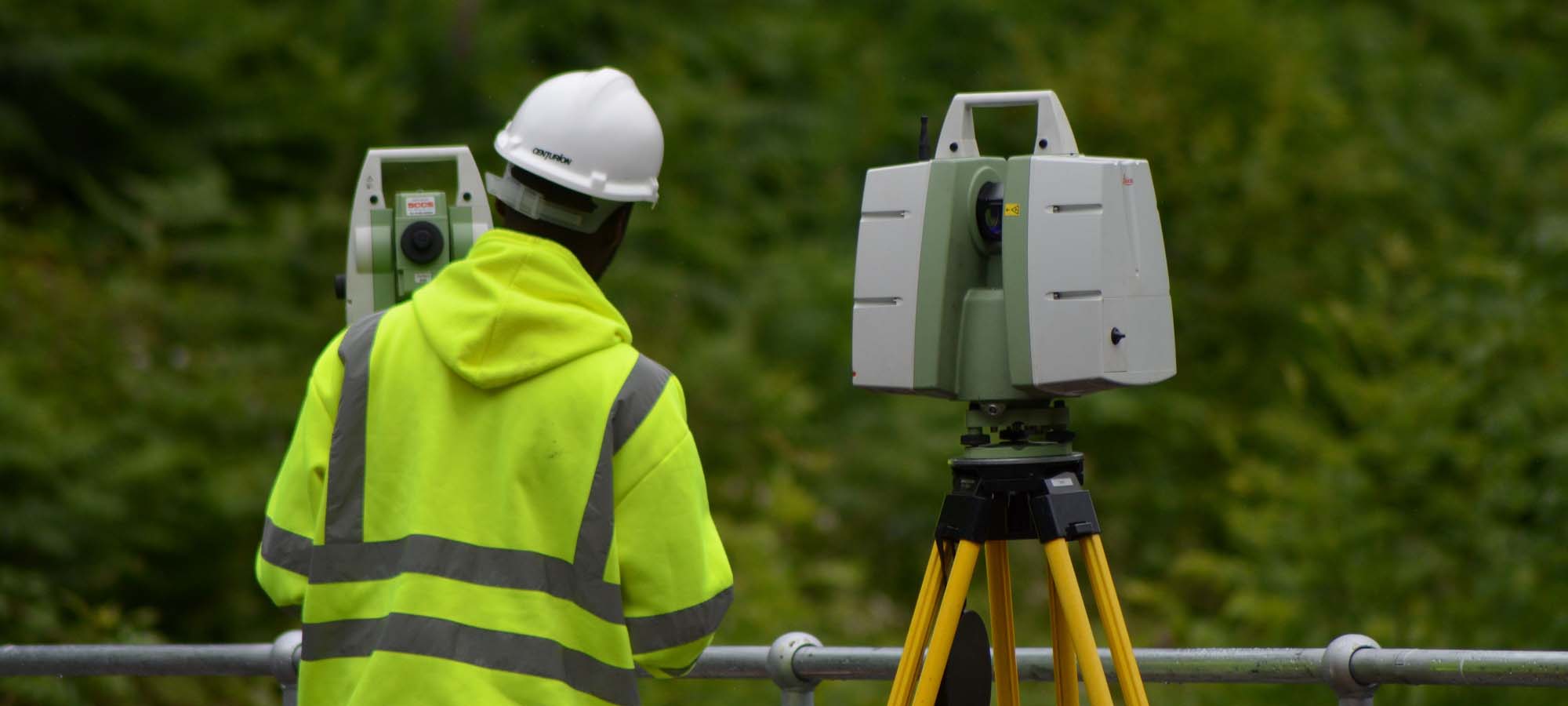
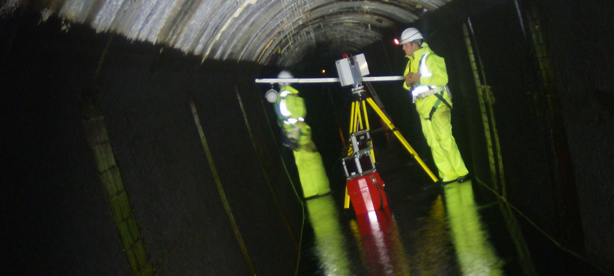
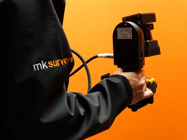
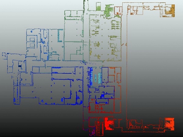
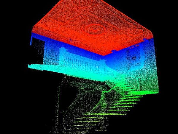
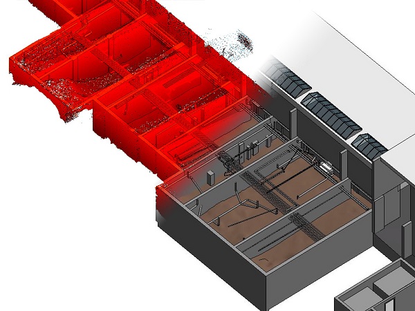
Handheld 3D Laser Scanning
ZEB-REVO - used to acquire survey data quickly and accurately for BIM survey model creation and measured building surveys.
A handheld Simultaneous Location And Mapping (SLAM) mobile laser scanning device that enables building internals to be recorded unobtrusively on site in a fraction of the time conventional methods require. All to within RICS tolerances with the resulting ‘pointclouds’ processed into any required format, whether 3D BIM models or 2D line drawings.

Mobile Mapping and measurement using the latest technology;
All data is collected remotely from a moving vehicle to survey grade accuracies whilst drastically reducing man hours and addressing critical health and safety considerations on site.
Speed - Accuracy - Safety
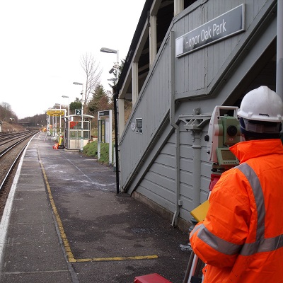
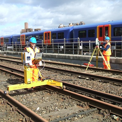
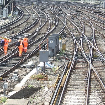
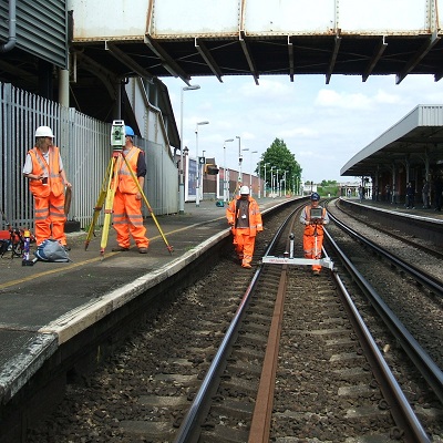
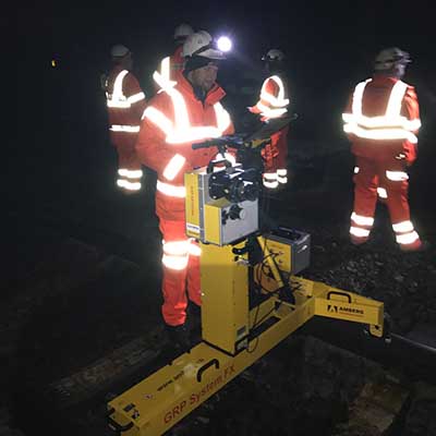
MK Surveys are RISQS (Railway industry supplier qualification scheme) approved via audit and have a railway division comprising of 20+ PTS certified staff. In May 2019 we were awarded the highest 5 star RISQS rating for the fifth year running.
We have worked on numerous railway projects across the UK carrying out the following types of survey:
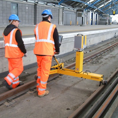
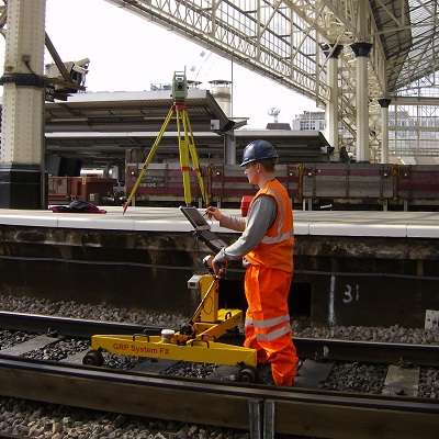
Topographical & Track surveys
Platform gauging clearance surveys
Profiles for clearance into ClearRoute™ format
Under Track Crossing (UTX) surveys & monitoring
Deformation monitoring
Drainage information with catchpit invert levels
Underground utility service tracing surveys
CCTV Drainage surveys
Full 3D CAD models for buildings, structures etc.
Measured Building Surveys
Surveys for people movement
Height & Stagger Surveys
Data can be issued in many formats including:
AutoCAD
Microstation
MX Genio
ClearRoute™
3D registered point clouds
Legion Compatible
TruView

 mail@mksurveys.co.uk